Coastal beach-dune dynamics and management in the CLLMM under future climate change
Project Lead: Patrick Hesp (Flinders University)
Project Team: Adrian Werner, Graziela Miot da Silva, Evan Corbett, Elijah Reiger, Cristina Solorzano Rivas (Flinders University)
Status:
Project Overview
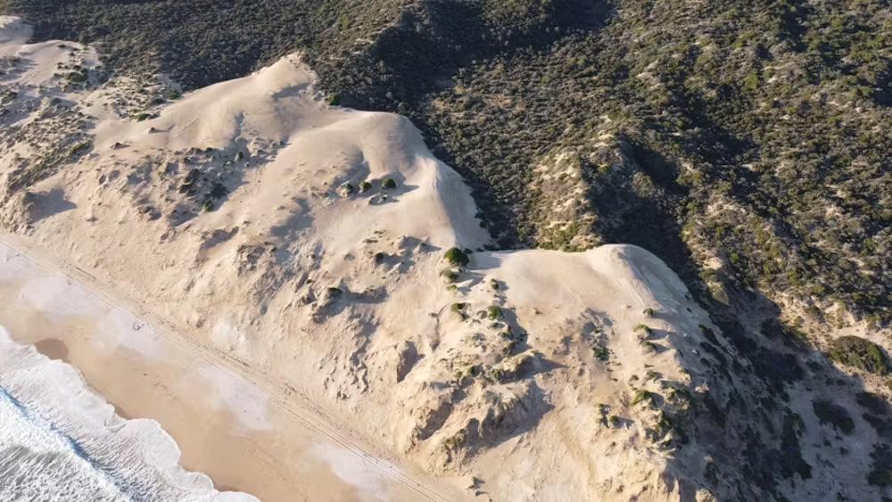
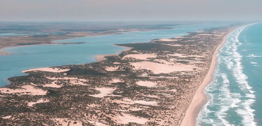
Coastal dunes are highly vulnerable to the effects of climate change. Factors such as rising sea levels, shifts in wind patterns, and changes in wave dynamics contribute to the erosion of shorelines and the inland movement of coastal dunes. A 2024 study examining a 2-km section of Younghusband Peninsula revealed significant shoreline erosion, occurring at rates of up to 3.3 m/year, and dune migration moving inland at rates of up to 10 m/year.
Due to the potentially rapid changes in this dynamic coastal dune environment, it is essential to implement monitoring strategies to observe shoreline erosion, sea level rise impacts, and dune migration.
This project is focusing on understanding the historical and current beach-coastal dune conditions, the future rates of dune migration, and the mitigation strategies required in response to future climate change and sea level rise.
The project involves broad investigation approaches to study coastal dune dynamics in the region, including:
review of publicly available documents, including council and government reports, on coastline changes and adaptation strategies for beaches and dunes in the region from Victor Harbor to Kingston.
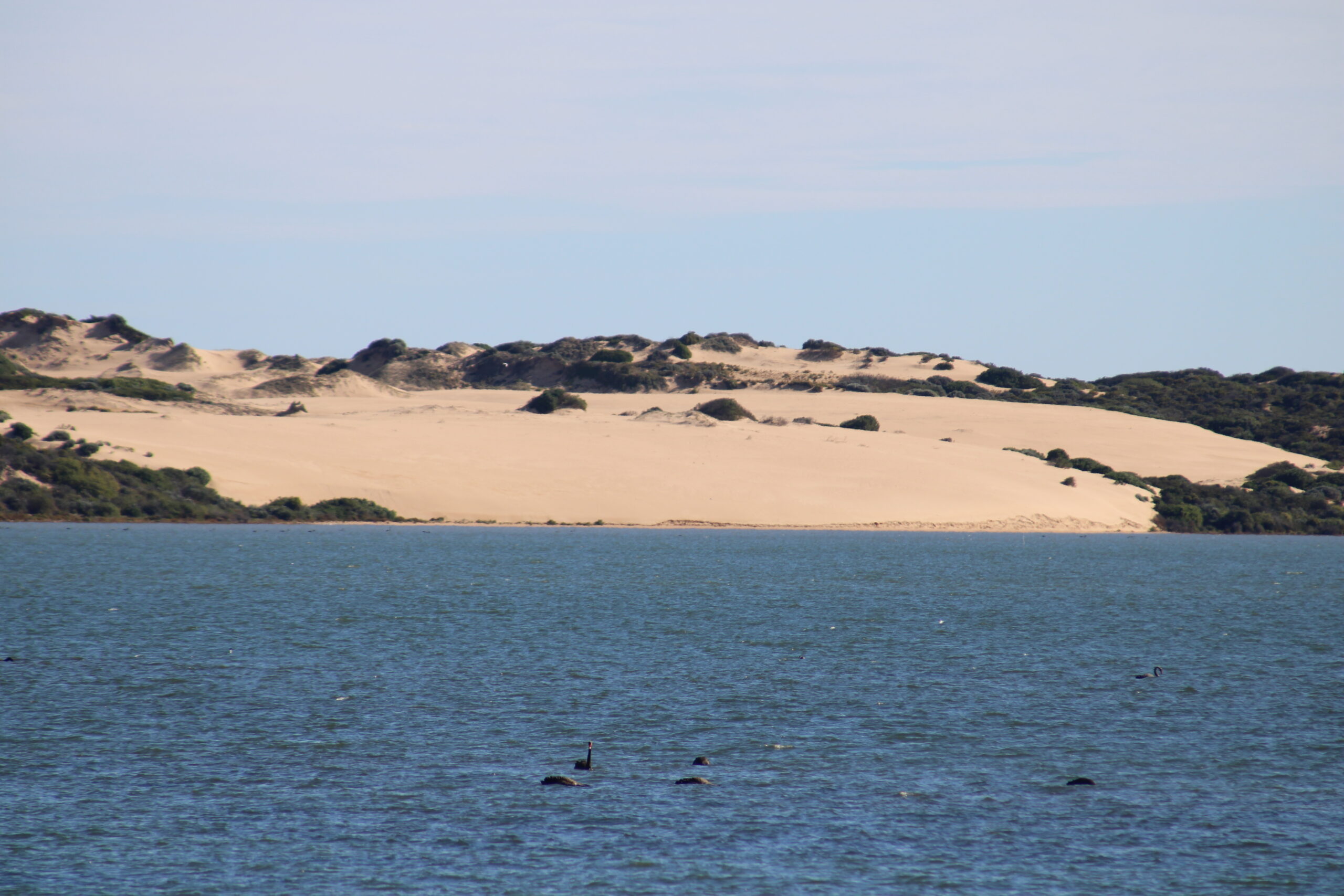
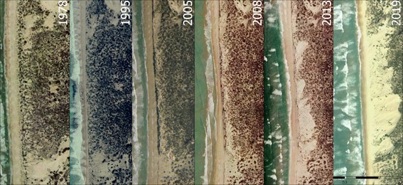
Historical and current dune field analyses to analyse dune field morphological changes and vegetation cover along the Sir Richard Peninsula and Younghusband Peninsula (Murray Mouth to Kingston) over four periods from the 1940s to the present.
Analytical and numerical modelling to utilise the X-Beach model and the Bruun rule to predict future beach and dune changes in response to sea level rise for representative sections of the coast. This includes examining a range of surf zone-beach types (narrow, steep, reflective beaches like Port Elliot and wide, flat, dissipative beaches like Goolwa) and various wave energies (Goolwa vs Kingston).
Groundwater monitoring to establish a long-term monitoring site to observe hydrogeological changes (e.g. groundwater level, salinity, groundwater wave propagation) and dune responses along a representative transect in the region.
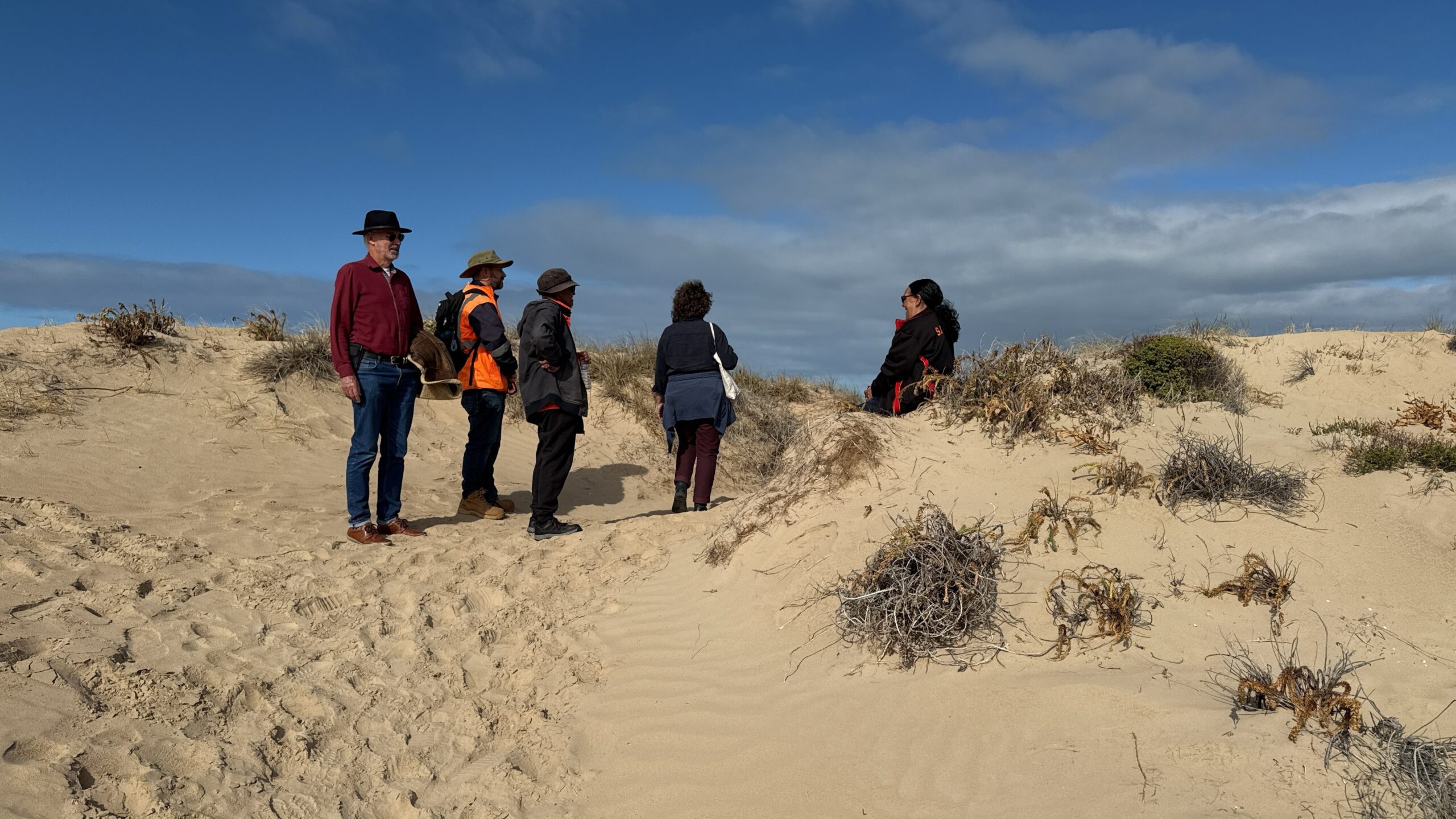
The project has strong connections with the community, First Nations, and research-users. Key stakeholders, including the Alexandrina Council, Victor Harbor Council, Hills and Fleurieu Landscape Board, SA DEW, the Coorong District Council, and the Coastal Protection Board, will have opportunities to guide the project’s direction and delivery.
The project will inform management and decision-making by:
Enhancing understanding of beach and coastal dune dynamics in the region
Increasing awareness of the broader impacts of climate change in the CLLMM region and potential mitigation measures.
First Nations culture and traditions are rooted within an ancient historical connection with country and countless generations of studying their local environment as a way of life. First Nations traditional ways of life, including land and water management, sustainable harvesting, and the conservation of local species can provide vital perspectives into the ways we manage the lands and waters into the future.
This project holds significance to First Nations people through their connection to the coastal dunes in the Ngurunderi creation story, and through their cultural heritage sites (e.g. freshwater soaks and burial grounds in the dunes). The project will work towards impact reduction, climate mitigation and potentially future adaptation to the cultural traditions associated with these sites.
Informing and working with First Nations people to discover the likely environmental changes to occur change to the coastal dunes may assist in working to reduce the impact on the associated cultural heritage sites but also plan for potential future adaptation and management of these sites.
Additionally, any shift, breach or other change to the coast dunes may directly influence other cultural values such as cultural waters (e.g. the Coorong), Nga:tar (totem species) and other cultural sites on the mainland (e.g. in the case of dune breach/sea water inundation)


